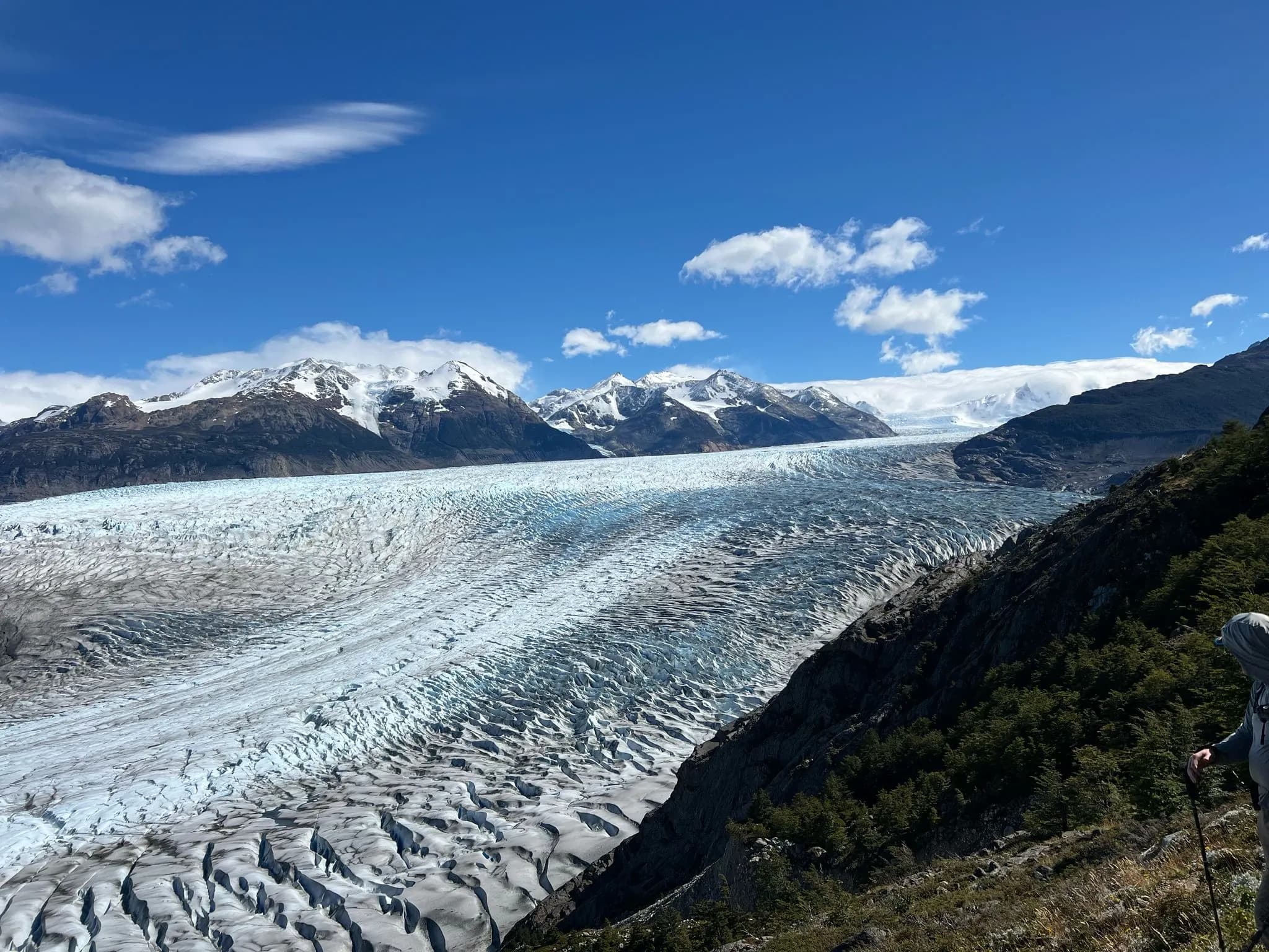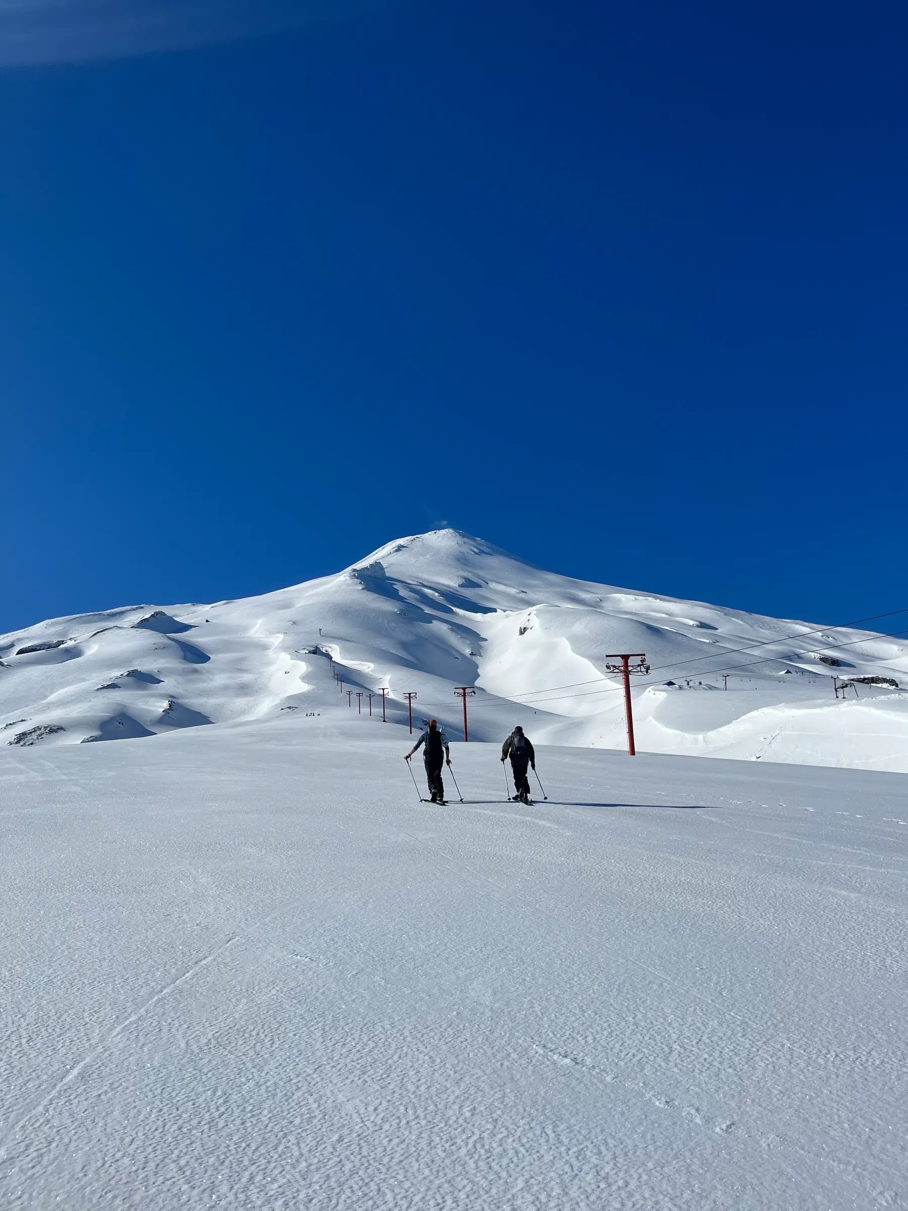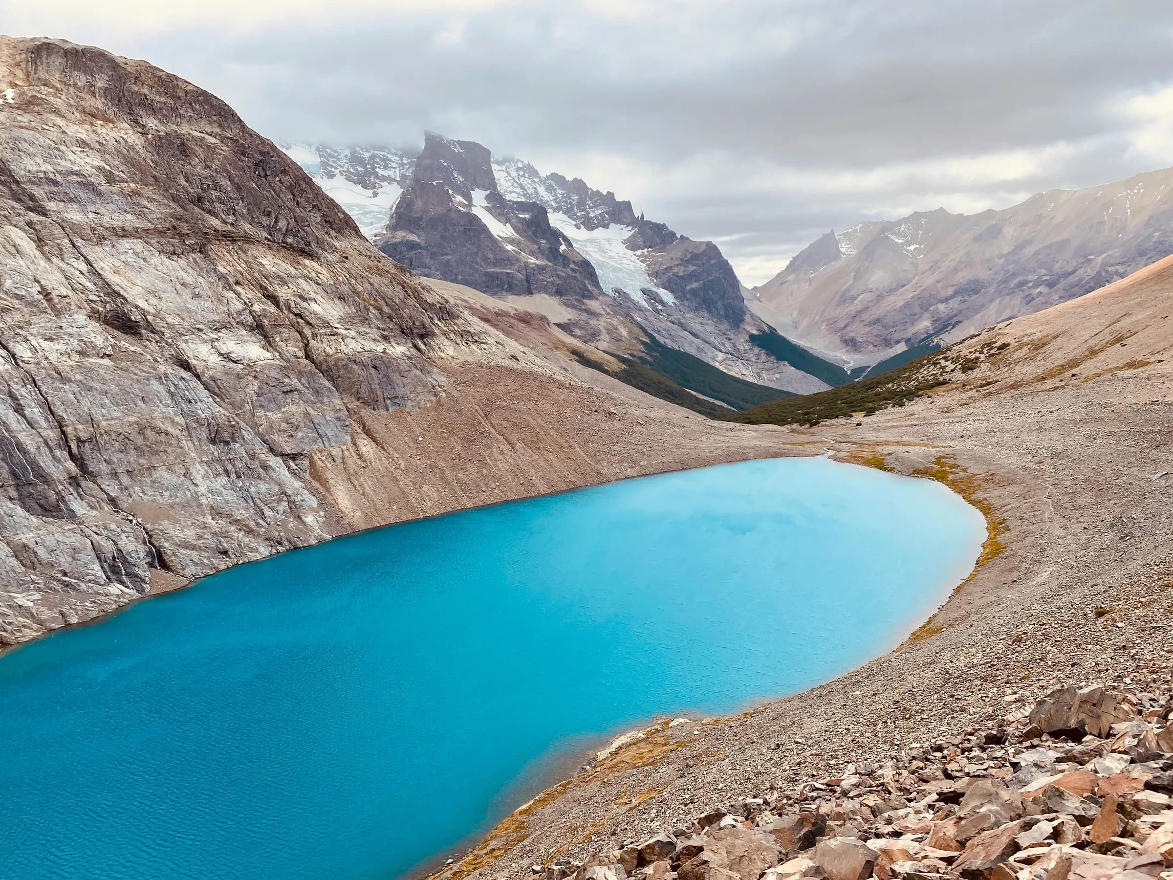
Las Horquetas is the multi-day trek through Cerro Castillo National Park, in the Aysén region of Chilean Patagonia. CONAF lists it at about 53 km (33 mi), usually walked in four days, crossing two mountain passes and finishing below the jagged spires of Cerro Castillo and the glacial lagoon at their base. There are no refugios, no restaurants and no beds on the route. You carry your tent, stove and food, and you sleep in four designated campsites.
We guide in Torres del Paine, and the question we get most often from people who have already done the W is "what next?" For experienced trekkers who want fewer people and a more self-sufficient trip, Las Horquetas is often the answer. This guide covers what the route actually involves, where the numbers you read online come from, and how it compares with the W.
Las Horquetas at a glance
- Park: Cerro Castillo National Park, Aysén region, about 64 km (40 mi) south of Coyhaique along the Carretera Austral
- Distance: about 53 km (33 mi) per CONAF; see the note below on why sources differ
- Days: 4 days and 3 nights is the standard plan; CONAF gives a range of 3 to 5 days
- Elevation: roughly +2,000 m / -2,500 m (+6,560 ft / -8,200 ft) according to the park's trail page
- High points: Portezuelo Peñón, about 1,300 m (4,265 ft), and the pass above Laguna Cerro Castillo
- Sleeping: 4 designated campsites, with a latrine and a nearby water source; camping anywhere else is not allowed
- Self-guided season: roughly December to April; from May through November the park restricts self-guided access
- Start and finish: Las Horquetas entrance on the Carretera Austral; exit at Estero Parada, then about 6 km (3.7 mi) of gravel road to the village of Villa Cerro Castillo
Why the numbers don't match
If you have read a few trip reports, you have seen distances from 51 to 56 km and pass heights from 1,300 m to over 1,400 m. That is normal for this route. GPS tracks differ depending on whether people include the gravel road into Villa Cerro Castillo, the side trip to Laguna Duff, or a detour to the glacier lagoon near El Bosque.
We use the official figures. CONAF lists the trail at 53.5 km. The park's own trail page breaks it into five stages that add up to about 45 km from the Las Horquetas entrance to the Estero Parada exit, plus the walk on the road into the village. The same page puts Portezuelo Peñón at about 1,300 m. You will also see 2,675 m quoted for the summit of Cerro Castillo; Chile's national tourism board and the Ruta de los Parques both give 2,318 m (7,605 ft).
Where Cerro Castillo National Park is
Cerro Castillo sits in the middle of Aysén, the region between the Lake District and Magallanes that the Carretera Austral runs through. The park covers 143,502 hectares across the communes of Coyhaique and Río Ibáñez. It was created as a national reserve in 1970 and became a national park in 2018.
The landscape is lenga and ñirre forest in the valleys, open alpine terrain above the treeline, hanging glaciers and fast, cold rivers fed by snowmelt. The park's signature is the huemul, the endangered South Andean deer. CONAF describes Cerro Castillo as the part of Chile where it is easiest to see one, and the estimated population across Chile and Argentina does not exceed about 1,500 animals.
Most travelers fly into Balmaceda, the airport that serves Coyhaique, and reach the trailhead by road. The Las Horquetas entrance is on the Carretera Austral south of Coyhaique, and regional buses pass it every morning.
The route, stage by stage
The trek is normally walked from Las Horquetas toward Villa Cerro Castillo. The distances below are the stage figures published on the park's trail page; times are the park's estimates for an average hiker with a full pack.
Day 1: Las Horquetas to Río Turbio (15.4 km / 9.6 mi, 5–6 hours)
You register at the entrance hut and start on the long, gentle part of the route: pampa, muddy stretches, lenga forest and the first stream crossings as the trail follows the valley of the Río Turbio. Elevation gain is modest, which makes this the easiest day on paper. What slows people down is wet ground and the crossings themselves.
Río Turbio campsite has 16 sites, a latrine and water about 200 m away. Since every group entering on a given day aims for it, it is the camp that fills first.
Day 2: Río Turbio to El Bosque via Portezuelo Peñón (9.8 km / 6.1 mi, 5–7 hours)
Shorter in distance, harder in effort. The trail climbs out of the valley to Portezuelo Peñón, about 1,300 m, then drops on loose rock toward El Bosque. The pass is exposed, and in Patagonia the wind usually builds through the day, so leave camp early and plan to be over the top before midday. In early season, snow can linger on the pass.
El Bosque campsite has 20 sites in the forest, a latrine and water about 50 m away. Many trekkers walk up to the glacier lagoon near camp in the evening.
Turning back right at a pass doesn't happen often. The real decision is made the day before, with the forecast and the state of the group in front of you. In the mountains it is always better to prevent than to regret.
Day 3: El Bosque to Laguna Cerro Castillo and down to camp (9 km + 3.6 km / 5.6 mi + 2.2 mi, 7–9 hours)
This is the day people come for. A steep climb above the treeline takes you to Laguna Cerro Castillo, the turquoise lagoon directly below the spires and glaciers of the mountain. From there the route climbs again over the high pass above the lagoon, the most exposed section of the trek, before descending to Porteadores campsite. The park's stage table counts El Bosque to Porteadores as 9 km and 7–8 hours, and Porteadores to Neozelandés as another 3.6 km and about 2 hours.
Most four-day plans continue to Neozelandés. Porteadores has 12 sites and 2 latrines; Neozelandés has 15 sites, a latrine and water about 150 m away. Neozelandés sits in an amphitheater of peaks and is the base for the side trip to Laguna Duff.
If the weather turns, the park notes an alternative exit from Laguna Cerro Castillo down the Mirador Laguna trail, which shortens the trek.
Day 4: Neozelandés to Estero Parada and Villa Cerro Castillo (7.7 km / 4.8 mi, about 4.5 hours, plus about 6 km of road)
The last day is mostly downhill through forest to the Estero Parada exit. From there a gravel road of about 6 km (3.7 mi) leads to Villa Cerro Castillo, a small village on the Carretera Austral with a few places to eat and sleep and buses north to Coyhaique and south toward Cochrane. If you add the morning detour to Laguna Duff, plan for a longer day.
Stream crossings
Every trip report mentions water, and for good reason. The park has installed bridges on some crossings, but other streams in the Río Turbio and El Bosque valleys are forded on foot, especially on day one. Depth depends on snowmelt and recent rain: shallow in a dry stretch of late summer, knee-high or more after a wet week.
What works:
- Pack everything that must stay dry (sleeping bag, warm layers, electronics) in dry bags inside your pack.
- Carry closed-toe sandals or light camp shoes for the crossings so your boots stay as dry as possible. A Chilean outdoor outlet that walked the route recommends exactly this.
- Use trekking poles, face upstream and unclip your hipbelt and sternum strap before stepping in, so you can drop the pack if you fall.
- Cross early in the day when you can. Glacier-fed streams usually run higher in the afternoon.
Our guide on choosing between hiking boots and trail shoes in Patagonia covers footwear for wet trails in more detail.
When to go
The park's planning page says January to March are the most suitable months, and that November, December and April are "very variable." From May through November the park applies its winter protocol: self-guided access is restricted, and anyone entering needs prior authorization and a certified mountain guide.
In practice, that leaves a self-guided window from about December to April, with exact dates set each year by the park. A few things to weigh:
- December and January: long days, but this is when the black horseflies (tábanos) are out in the lower valleys. Long sleeves help.
- February and March: usually the most settled period, and the most popular.
- April: autumn color in the lenga forest and very few people, with shorter days, colder nights and a real chance of snow on the passes.
Patagonian weather does not follow the calendar. Plan a buffer day in Coyhaique or Villa Cerro Castillo so you can shift your start if a front comes through.
Park rules, tickets and entry hours
The rules are simple, and rangers enforce them.
- Tickets: buy a multi-day ticket before you go. The park's trail page says Las Horquetas needs a ticket of three days or more, validated at the entrance. Tickets are sold on the park's website and, according to the park, cash is not accepted at the gate.
- Registration: sign in at the Las Horquetas entrance hut before you start.
- Entry window: the park's trail page lists 08:00 to 14:00 for the Las Horquetas entrance. Older guides quote 07:00 to 13:00. Check the current hours before you travel, because arriving after the cutoff means losing a day.
- Camping: only in the four designated campsites, within each one's capacity for the season.
- No fires, no drones and no pets. Cook on a stove in the designated areas and carry out all your trash, including food scraps.
- Huemul: if you see one, keep at least 30 m (100 ft) away.
- Hantavirus: Chile's tourism board advises avoiding contact with rodents and their droppings. Keep food sealed and your tent closed.
The park also notes that there are no guides or porters for hire at the entrance. If you want a guide, arrange it before you arrive.
What to carry
Las Horquetas is fully self-supported. Everything for four days goes into your pack at the trailhead.
Shelter and sleep
- A sturdy tent that handles strong wind; the higher camps are exposed
- A sleeping bag for below-freezing nights (one Chilean outdoor outlet recommends a -10 °C bag) and an insulated mat
Clothing
- Waterproof jacket and pants, warm mid-layer, hat and gloves
- A spare set of dry clothes sealed in a dry bag, for camp only
- Boots you trust on loose rock, plus sandals or camp shoes for crossings
Food, water and cooking
- Four days of food plus an emergency day
- Stove and enough fuel
- Water filter or purification tablets
Navigation and safety
- Offline map with the route loaded, and a backup battery; parts of the trail are faintly marked, which matters in cloud
- Headlamp, first aid kit with blister care, whistle
- A satellite messenger is worth carrying: much of the route has no phone signal
Las Horquetas vs the W Trek
Both are four- to five-day treks in Patagonia, and both deliver glaciers, lakes and granite or rock spires. The experience on the ground is very different.
| Las Horquetas | W Trek | |
|---|---|---|
| Region | Aysén, Northern Patagonia | Magallanes, Torres del Paine |
| Distance | About 53 km (33 mi), 4 days | About 68 km (42 mi), 5 days on our guided W |
| Sleeping | Designated campsites only | Refugios and campsites |
| Food on the trail | None; you carry everything | Refugios have restaurants |
| Bookings | Multi-day park ticket; campsites by capacity | Every night reserved before you enter the park |
| Terrain | Two exposed passes, fords, faint sections | Well-marked trail, bridges, no high passes |
| Crowds | Low | High in summer |
Choose Las Horquetas if you have backpacked before, can carry 12 to 15 kg for four days, are comfortable with stream crossings and want quiet trails and huemul country.
Choose the W if you want refugio dinners and a bed, a well-marked trail, or it is your first multi-day trek in Patagonia. Our guided W Trek covers about 68 km over five days with every night booked for you, and our Torres del Paine travel guide explains the park in depth.
If what draws you to Las Horquetas is the self-sufficiency and the passes, the guided O Circuit in Torres del Paine is the closer match: about 138 km over eight days, including John Gardner Pass.
Las Horquetas suits travelers who have already done the W, or who haven't and want something less famous and less conventional. There are no serviced campsites and no phone signal, and you feel the wild side of Patagonia: alpine views on a true trekking route in northern Patagonia.
Guided or on your own
Las Horquetas can be walked without a guide during the summer season, and many people do it that way. It suits you if you have done multi-day treks with a full pack, can navigate on a faint trail in poor visibility, know how to cross moving water, and are prepared to manage a sprained ankle or a cold tentmate with no phone signal.
A guide changes three things. Decisions about passes and crossings are made by someone who reads that terrain regularly. Logistics (tickets, transport to the trailhead, food, the return from Villa Cerro Castillo) are handled before you arrive. And from May through November, a certified guide is the only way to enter the park.
Planning a trip to Aysén with us
Aysén is not one of our scheduled trips. We plan it as a tailor-made journey, usually combining Las Horquetas with other parts of the Carretera Austral, such as the Marble Caves on General Carrera Lake, or pairing it with Torres del Paine further south. If you are still deciding between regions, our where to go in Chile page lays out the options by season, and the Patagonia destination page covers both Aysén and Magallanes.
Tell us your dates, how much trekking you have done and what you want from the trip, and we will tell you honestly whether Las Horquetas fits.